
Our Earthwatch team of teachers will be working with Scientists in San Gregorio and Xochimilco, Mexico from July 21-27, 2019. This area is just south of Mexico City and was once part of the five large lakes that covered Mexico Valley which the Aztecs helped to settle. During this time they developed Chinampas, man-made islands within the lakes for agricultural use. These were highly productive, planting maize, beans, corn, tomatoes and other food. They also formed a system of canals to be able to move easily throughout the chinampas.
When the Spaniards came into this area in the 1500s they introduced many plants and animals. Over time the lake system was drained and currently only 2% remains. This has caused environmental pressures to the area including: untreated water, agricultural runoff, introduction of invasive species, eutrophication (increase of nutrients in the water) and pesticide accumulation.
The research will focus on the recovery of these endangered ecosystems and the canals affected by pollution and agricultural practices and work on methods to improve water quality for crops and maintaining areas for native species. As teachers we will be participating in this research and bringing back this information to our students to use in our community and hands-on lessons.
By Sue Cullumber
Day Numero Uno: July 22, 2019
¡Saludos! Wow, what a day to introduce our team to a week long of research in Las Chinampas. Excellent breakfast, interesting ride through the heart of Mexico City, with an even more excellent driver, Eduardo, who brought us safely to and from our site. With the sun shining and birds chirping, we were quickly introduced to the field of Chinampas wetland conservation research and split into three groups. Our groups focused on water physio-chemistry, soil sampling, and canal morphometry.
Water physio-chemistry focuses on PH, temperature, and the amount of bacteria and organic material found in the water. Some of the activities included taking water samples from the canal, testing the water at different depths within various locations in the canals, and using a Secchi Disk to determine water clarity.

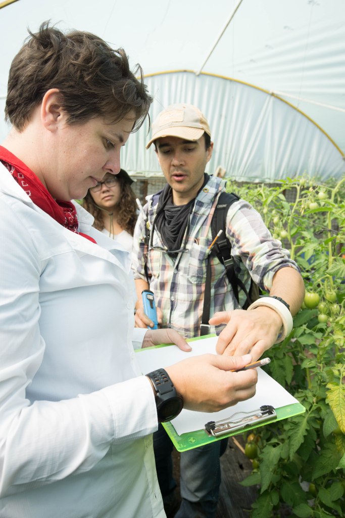
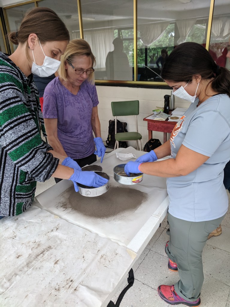
Soil sampling focused on the techniques used by farmers in the Chinampas to determine the amount of salt within their agricultural plots. The groups sampled soil from two different locations that were growing tomatoes and at each location five samples were taken by hand, placed in bags, and stored for later analysis in the lab.
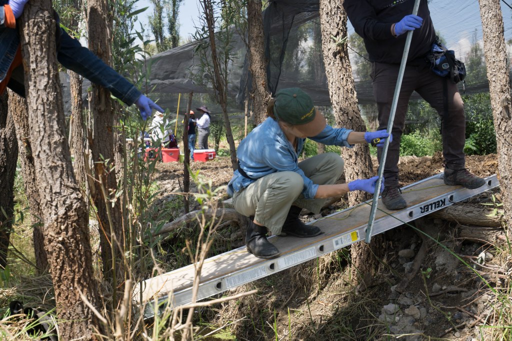
Canal morphometry focused on measuring the infrastructure of the canals, specifically the width, the depth, the flood-line indentation, and the shape of the canal bottom. The purpose of measuring is to monitor the change of the canals infrastructure over time. The groups used a ladder bridge placed across the width of the canal in order to take the needed measurements. These measurements were taken every four meters down the length of the canal.
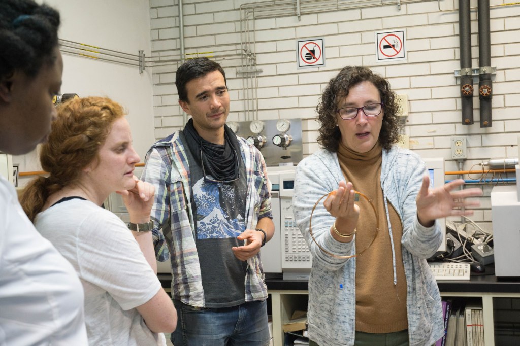
If these activities were not enough to fill our day we headed over to UNAM (National Autonomous University of Mexico) for a guided tour by the head of the research project, Dr. Claudia Ponce de León. She was incredibly well spoken, engaging, and walked us through every step of analyzing water samples. For example, one of the technologies she showed us is gas chromatography which can isolate organic matter. Also, she demonstrated another technology called the ultrasonic bath by cleaning some of our jewelry items and returning them nice and shiny, just as we concluded our tour.
All in all, a very full day. ¡Saludos!
Crystal and Sue
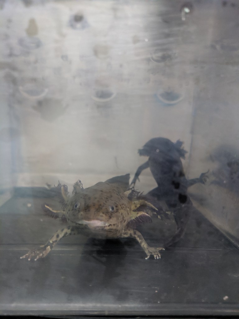
All About Axolotl
How well do you know these creatures? Their smiling faces bring joy to countless people around the world, but our neotenous (neoteny: creatures that keep their juvenile features for longer and don’t metamorphose before sexual development) – friends are in critical danger. Their habitats though intact are changing rapidly, and are filling with competitors that are taking over their native homes. The number one threat to axolotl is the tilapia. Young axolotl lack front limbs and aren’t as efficient at getting food as the tilapia. What’s worse, they’re also less capable of defending themselves
The work being done in Dr. Ponce’s lab goes toward conserving these wetland habitat and restoring a healthy balance to the local ecosystems. With the combined efforts of scientists, farmers, conservatories and the Earthwatch teams, we hope to see an increase in the wild axolotl populations before long.
Did you know:
- Axolotl eat mosquito larvae. Talk about pest control…
- Axolotl prefer to eat live food and are attracted to the motion of their prey. No frozen fish for these guys.
- Humans are neotenous too!
Macro-invertebrates – Day 2
Today we returned to the Xochimilco canals, this time for macroinvertebrate sampling and counting native & riparian plant species. The science team introduced us to the concept of bioindicators before dividing us into teams to get started.
How do bioindicators work?
Certain species are assigned a value, based on their tolerance of pollutants. Species that aren’t able to handle pollutants have a lower value, and the more tolerant species have a higher value. After counting the number of individuals of these species within a given location we can gauge the health of the habitat. If we have a high number of population-vulnerable species, then we know the water is good. On the other hand, if we find a large number of pollution resistant species then we know that
Another team counted the number of Riparian Zones and native vs. non-native plant species along the canals. We realized that many of the shrubs were difficult to identify because they had been cut the day before to reduce over-growth along the canal way. eventually we all found ourselves under the tent, sifting through the collected materials from the canal sample sites. This work was quite time consuming, but eventually we all found ourselves in a peaceful, focused state. It was amazing how drastically different the fauna & flora were in sites that were only a few meters apart. It’s a reminder of how small ecosystems can be, and how the slightest difference in sun exposure, temperature, or oxygen levels resulted in an entirely new combination of creatures.

Something that caused a bit of controversy among our team was the method of sorting that was used. In order to get an accurate count and properly identify the invertebrates we found, we had to find a way to keep them separate and still. We put each individual insect into a bottle partly filled with alcohol in order to euthanize them. At first it seemed counterproductive to kill organisms in the process of conservation, but the results of this research goes toward a greater good.
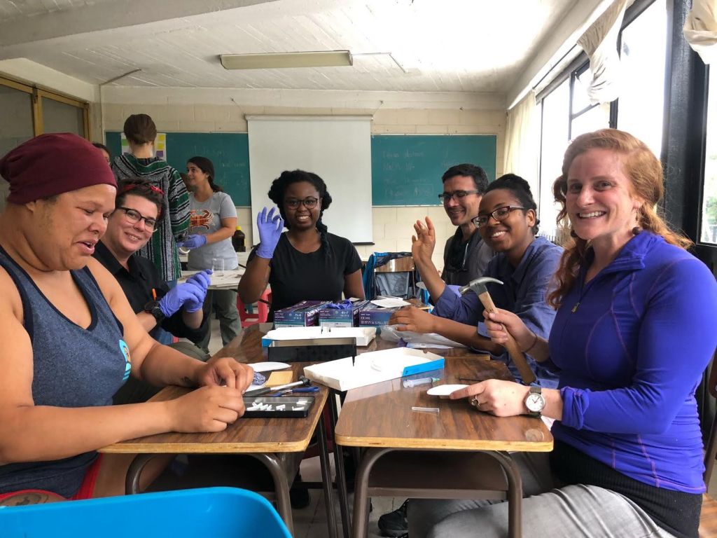
Finally we took soil samples from two different greenhouses and brought them back to Casa Xilta for Soil Chromatography in the afternoon. There was much wait time and swirl time of soil samples….as we wait to complete the process tomorrow morning and compare greenhouse soil samples in two different locations of the Chinampas!

Until tomorrow,
Milan and Holly
Continuing Questions:
- What do you think about this method of obtaining information?
- How many riparian species are in your neighborhood or local park.
